


The LEA RIVER VALLEY: THREE MILLS ISLAND and the OLYMPIC PARK
A little introduction and a couple of ideas…
The map shows you the course of the RIVER LEA, with its canals and the reservoirs within Greater London. I have pointed out the LONDON STADIUM, to the South of the OLYMPIC PARK
WALTHAMSTOW VILLAGE


London from CHINGFORD
The LEA VALLEY REGIONAL PARK (LVRP), is a regional natural park which has many attractives, from <<<<BOW CREEK (BLACKWALL), —the mouth of the river Lea— to the original springs in HERTFORDSHIRE, to the North of Greater London.
Natural spaces and former industrial buildings mostly related to the treatment and provision of drinking water to London (part of the water consumed in the NE of the metropolis is supplied from here), a couple of small museums, places to eat and drink, and the chance to do a good exercise.
A lot is an offer.
Especially this a place to walk and cycle freely, in contact with nature. You are going to find panels with maps and information. There is also accommodation in the area : campsites, cottages, and an a youth hostel.
Not only a nature is available. You can easily reach the ancient villages like LEYTON, LEYTONSTONE (where ALFRED HITCHCOCK and DAVID BECKHAM were born) or WALTHAMSTOW (where the man who designed the modern bicycle was born) to the East of The Valley Or HOMERTON, HACKNEY, STOKE NEWINGTON o TOTTENHAM, to the West.
WALTHAMSTOW and its WETLANDS


The OLYMPIC PARK is physically part of The Valley but is not run by its authority. From it you you can access to the North (HACKNEY MARSHES) or to its South (THREE MILLS ISLAND AND GREEN>>>>, and the <<<<BOW CREEK and EAST INDIA DOCK).
Although this web deals only with the OLYMPIC PARK and THREE MILLS, I would like to take the opportunity to encourage you to reach WALTHAMSTOW, from STRATFORD by bus.
The site of the ancient VILLAGE (including a small local museum and the church) is only a mile away from the Victorian suburb (which you can reach on the VICTORIA LINE , directly from Central London) or on the OVERGROUND.
Walk the whole of the HIGH STREET and, after enjoying the longest street market in the world, carry on COPPERMILL LANE or, still better, LEYCHA ROAD (conservation area, charming houses) and then COPPERMILL LANE. This route takes you almost to the banks of LEA RIVER, and to the feet of the WALTHAMSTOW WETLANDS. You will not miss the COPPERMILL PUB, and you can visit the COPPERMILL TOWER.
If you cross the river, along the picturesque HIGH BRIDGE, you can have an cuppa in the BOATHOUSE or in the café in SPRINGFIELD PARK. After the park (which is uphill), you will find yourself in STAMFORD HILL, where a large Jewish Ultra-Orthodox community lives.
North of the OLYMPIC PARK: the HACKNEY MARSHES
Here it is another suggested route, starting at the OLYMPIC PARK:
from the HOCKEY AND TENNIS CENTRE or from HERE EAST


THREE MILLS ISLAND
On the map, the HOUSE MILL, she the visitor centre is. To the North, the STRATFORD HIGH STREET. To the West, BROMLEY-BY-BOW

Suggested routes.
To or from LIMEHOUSE
To or from BROMLEY/BOW
To ABBEY MILLS PUMPING STATION and, then,
To ALL SAINTS, WEST HAM
To/from the OLYMPIC PARK
Remember that you can reach this area and from LIMEHOUSE walking or cycling the whole length of the LIMEHOUSE CUT, it is a relaxing 30 min. walk, without much interest (blocks of contemporary apartments. This former industrial land, was redeveloped mostly the first decade of the century, on the way to the OLYMPIC GAMES, and in its wake.
Also walking or cycling from BROMLEY-BY-BOW. If you come from this side, you will go past a TESCO supermarket which can be useful.
If you come from the DLR PUDDING MILL LANE station is located close by. The ABBA VOYAGE show ARENA is beside the station.
Now if you come on the bus 25, get off MARSHGATE LANE or WARTON ROAD. You will cross STRATFORD HIGH STREET and THREE MILLS ISLAND, is 10 minutes away, for example alongside BISSON ROAD. You can enter the SUGAR HOUSE ISLAND development, as well, and cross the small pedestrian bridge, at the end of ZINC STREET. Once on the other side you are inside the LVRP.


Currently, part of the former industrial complex (c.20 buildings, as it used to be a bottling plant until the 70s, by the <<<<CHARRINGTON BREWERY of MILE END) has been converted into cinema studios. The Opening and Closing Ceremonies of the 2012 events were rehearsed in these studios.
A school occupies the CLOCK MILL.
Sundays only, in the MILLER’S HOUSE (rebuilt in 1995, as it had been destroyed during the War) you are going to find a small exhibition, a shop-café, where some history booklets are sold, and lavatories. You are going to get all in offer, plus a tour of 1 h., for £10.
THE HOUSE MILL, most ancient building date from the c.18. High on the wall a plaque reminds you that the largest TIDAL MILL in Europe, belonged to a family of French HUGUENOTS, the BISSON (in 1787, but the LEFEVRE and DEBONNAIRE families had, as well, started the business). The METCALFES took over later on.
For centuries, the grain was milled in dozens of mills, along The Valley, and flour was sold to STRATFORD or London bakers. Inside you will see how the tidal Lea powers the grinding mechanism. This was the largest tidal mill in the world.
In the times of war (for example, the period of the invasion by the Spanish ARMADA) the mills of the area were producing gunpowder…
And, as well, here, during the GIN CRAZE era, the spirit was distilled here, and in the 19th c. the mills were acquired by NICHOLSON of CLERKENWELL (now, a brand of pubs).
From THREE MILLS, to the South, you can also see, in what used to be the BROMLEY-BY-BOW GASWORKS, of the IMPERIAL GAS LIGHT AND COKE , one of the largest old gas holders in the world. Gas was produced here until the 1970s.

MEMORIAL (not a GASHOLDER!)

Towards the VIEW TUBE and the OLYMPIC PARK

Photo from LONDONXLONDON.COM
When you walk the GREEN, you will see some pieces of public art: REACHING OUT, a statue of a black woman by THOMAS J. PRICE) and the HELPING HANDS, MEMORIAL to the sewage workers in an accident in Victorian times.
From the GREEN note, to the East, the former ABBEY MILLS PUMPING STATION>>>>, behind the new one. The black waters from the metropolis are pumped toward the BECKTON treatment plant. The recently built THAMES TIDEWAY TUNNEL reaches the new station.
A bridge over the residential canal allows you to visit the SUGAR HOUSE ISLAND development, where former industrial buildings blend with contemporary apartments and offices.

On your way to or from the THREE MILLS, do not miss the former LOCK-KEEPER COTTAGE, part of the chemical works belonging to the man who came up with the NAMES OF CLOUDS, LUKE HOWARD
Once you have crossed the HIGH STREET you are going negotiates the BOW BACK RIVERS, and, in 15 minutes, you will be in the OLYMPIC PARK, passing by the PUDDING MILL LANE DLR station (ABBA VOYAGE).
Go up the ramp, on the GREENWAY, and you have found the VIEW TUBE, a community and educational centre with a café and some small shops, all built up with old ship containers.
And you are walking on top of one the main sewers of London…
You could be hiring bikes, to go around the OLYMPIC PARK or towards other East London neighbourhoods. NIGEL is the man in charge here.
You will enter the OLYMPIC PARK through the EAST BANK quarter, a cultural and educational one, here occupied by the MARSHGATE facilities of UNIVERSITY COLLEGE LONDON-EAST. More to the East, the POOL ST. building of UCL-EAST.
Detour: from THREE MILLS to old WEST HAM
Map from BRITISH ONLINE HISTORY

On the map, ALL SAINTS WEST HAM CHURCH, destination of this diversion

The CATHEDRAL OF SEWAGE is rarely open to the public. THAMES WATER, thought, opens some of its historical facilities

If, after the THREE MILLS GREEN you walk Southwards (turning right) BISSON RD., and then walk RIVERSIDE RD. and ABBEY LANE, you will get to the gates of the ABBEY MILLS PUMPING STATION, and after that, a beautiful Victorian terrace of houses.
However, if you turn right and walk ABBEY LANE., and then join the GREENWAY, the view is still better from up here.
ABBEY MILLS is the most iconic building representing the great project (in operation since 1868) of SIR JOSEPH BAZALGETTE that designed the sewage system that still serves the GREATER LONDON of today (a metropolis that has more than doubled the population (from 4 mil. To more than 9 mil.).
However, the building that you see is not anymore in operation, a it has been superseded by the modern STATION F, 200 m. away, since 1997. The sewage brought by two low-level sewers is raised by the station, to the NORTHERN OUTFALL SEWER which canalises it, by gravity and underneath the GREENWAY, to the BECKTON TREATMENT STATION.
ABBEY MILLS is the endpoint of the THAMES TIDEWAY TUNNEL. The sewage brought by this one is carried to BECKTON by a contemporary piece of engineering, the LEE TUNNEL.
When you feel ready , walk along ABBEY ROAD (ROAD!), cross the railway tracks and turn left into ABBEY ROAD DLR STATION (no, not the BEATLES landmark, that you are going to find in MAIDA VALE -near ST.JOHN’S WOOD LU Station) and right into BAKERS ROW where, in ABBEY GARDENS, small remains of one of the gates of the Cistercian STRATFORD LANGTHORNE ABBEY are preserved.
Now you understand: the famous pumping station was built on the site of a mill, which was owned by that ABBEY.
Finally you will walk ABBEY ROAD again until you reach the crossroads. Shops and eateries are in front of you, and probably you can al ready see the medieval fabric ALL SAINTS WEST HAM CHURCH, the mother church of this area. You are in the former village of WEST HAM. Nothing is left of that village. Rather uninteresting council estates around…
You are a short walk from STRATFORD BROADWAY. WEST HAM PARK is 10 min. away. GREEN STREET>>>>, 20 min. further East, in case you fancy a curry.
And up to here THREE MILLS ISLAND

The QUEEN ELIZABETH OLYMPIC PARK
On the map, the LONDON STADIUM. Beside, the ARCELOR MITTAL ORBIT. Still to the South, you have passed by the UCL-EAST buildings
STRATFORD CITY and STRATFORD BUS STATIONS

By the way, would you like to enjoy the opening ceremony of the OOGG?.


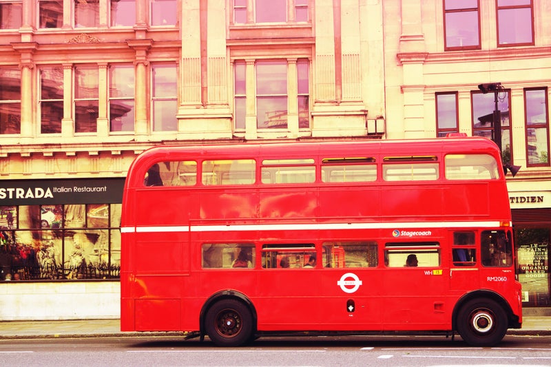
Dear reader, if you want to reach the OLYMPIC PARK directly from CENTRAL LONDON, the nearest main transport hub is STRATFORD: buses, LU, DLR, OVERGROUND, and ELIZABETH LINE. All those means of transport arrive at STRATFORD from many points.
Bus 25, however, before stopping at STRATFORD, runes alongside the HIGH STREET. You can gent off when you will be close to PUDDING MILL LANE DLR station.
Bus 388 enters the OLYMPIC PARK itself directly, from LONDON BRIDGE.
However, let me give you an idea: why not coming on a HIGH SPEED train from ST.PANCRAS STATION?. For the GAMES it was called, very appropriately, the JAVELIN. A SEVEN MINUTES journey!. You will alight at STRATFORD INTERNATIONAL, unless you want to continue on towards PARIS.


You are in the OLYMPIC PARK, built during the first decade of the century, up to 2012, and opened to host the OLYMPIC and PARALYMPIC GAMES that year. Remember that 2012 was a DIAMOND JUBILEE YEAR, for QUEEN ELIZABETH II (60 years on the throne) and to the OLYMPIC PARK title was added that of QUEEN ELIZABETH. As you remember, the queen would passed away in 2022, while celebrating another JUBILEE YEAR. So, welcome to the QUEEN ELIZABETH OLYMPIC PARK.
The celebration of the 2012 Games in London was considered a success. And that best the contribution of those events is the LEGACY they left, to EAST LONDON, especially. In that, the organisers were right.
Once the PPGG ended, the PARK was closed to the public and works started again. It was about to start the transformation of the precinct into a living, working and leisure area, in fact a group of districts.
And, thus, Olympic Park has been changing, since then, for years, always with new additions. Around 2030 the area is going to be completely redeveloped.
If you have entered the precinct from the South (<<<<THREE MILLS, HIGH STREET, PUDDING MILL LANE DLR Station, VIEW TUBE) the first venues you will see, after the UCL EAST buildings, is the LONDON STADIUM and the ORBIT.
The ARCELOR MITTAL ORBIT, at 115 m. is the biggest public art work in London, created by the artist ANISH KAPOOR. You will be taken up to the viewing decks on a lift, and then you can come down the slide…
Talking about public artworks, the OLYMPIC PARK is replete with them. Keep your eyes open and admire them!.
Who came up with the idea of creating a monument that would be so significant to London as the STATUE OF LIBERTY is to NEW YORK or the EIFFEL TOWER is to PARIS?. The London Mayor (2008~2016) Mr. JOHNSON. It seems that he pressed with that idea in a casual encounter in the restrooms, with a possible moneyed funder, Mr. MITTAL, owner of the steel works. That is why the ORBIT gets its full name. As for the ORBIT bit, ask the artist.

The current LONDON STADIUM is the former OLYMPIC STADIUM, remodelled, with a larger roof over the spectators (in 2012, for an aerodynamics reason linked to the athletic competitions, it only protected a third of them from the rain). The athletic track was kept (so the stadium could be the base of BRITISH ATHLETICS) but now under retractable stands. And the pitch can be adapted, as well, for rugby and American football. Non sporting events can be hold here, as well.
This solution -keeping the Stadium- followed after much debate, with some administrators in favour of the complete demolition after the GAMES (in fact, it had been built relatively on the cheap; the organisation was boasting that some of its parts were made from recycled materials).
Finally, the venue ended in the hands of WEST HAM UNITED FOOTBALL CLUB, the team of EAST LONDON, born in the THAMES IRONWORKS, a modest club, though, who pays a modest rent.
The AQUATICS CENTRE is to your right across the bridge over the canals. Two Olympic swimming pools and a jumping pool, in addition to being used in important competitions, are open to the general public: they are now a LEISURE CENTER. The venue, which had 2 temporary big stands, protruding towards the outside, through the huge side openings (no windows, during the GAMES), was designed by the practice of the late Iraqi architect ZAHA HADID.
To the Southwest side of the AQUATICS, in an area not easy to reach, there is a MEMORIAL to the victims of the NEW YORK TERRORIST ATTACKS of SEPTEMBER 11th 2001.
You can leave AQUATICS for later on, and continue walking Northwards, leaving behind the. PODIUM (toilets, restaurant, bar), the ORBIT and the STADIUM, alongside the gardens, a BOULEVARD named after TESSA JOWELL (the cabinet minister that supervised the candidacy and organisation of the GAMES, until 2010, when a new coalition government, TORY and LIBERAL-DEMOCRAT, was put in place, succeeding the LABOUR one. Note that, while here, you are walking between two canals, man-made, the RIVER LEA runs along the other side of the STADIUM.

To one side of the River Lea are these wetlands, the Waterglades. They may look natural, but are actually man-made; they are a way to sustainably recycle water that is collected on the rooftops of nearby buildings (the former Olympic Village), and turn it into clean water for gardening and toilet flushing. As well as this eco-friendly angle, there are habitats to encourage birds, bugs and other wildlife, and a great variety of trees and other plants. In terms of today’s walk, it felt like the most biodiverse environment, and a great spot to sit and do some birdwatching. Photo and text from SALTERTON ART REVIEW
To the right, the central part of the EAST BANK, which started opening in 2023, by the WATERWORKS RIVER (canal), is a predominantly cultural and educational district, housing a dance theatre part of the famous SADLER'S WELLS, a branch of the VICTORIA & ALBERT MUSEUM (V&A), the LONDON COLLEGE OF FASHION (moving here from OXFORD STREET), plus another UCL venue open to the general public, and as well, a new BBC SYMPHONY ORCHESTRA HQ, housing recording studios and venue for live music
For you to have an idea: in 2012, a huge grey marquee, housed the swimming pool where waterpolo was played; one of the sports arenas that was taken down as the organisation anticipated that it was not necessary for London. Definitely, who plays waterpolo in England?. From the start, and part of that legacy philosophy, WHITE ELEPHANTS were not wanted. You have seen how the previous venues are still fully used.
You will cross the river LEA. Note the CARPENTERS LOCK. The GUILD OF CARPENTERS of London, now a LIVERY COMPANY. In 1767 the Company purchased a farm estate at Stratford, which become a built-up district, dense with houses and factories, In 1886 it opened an evening institute on the Carpenters Estate there, offering classes in carpentry, joinery, plumbing, geometry, mechanical drawing and cookery. In 1891, the Carpenter's Institute had become a day school for boys.
You will continue North until you meet the main street, CARPENTERS ROAD.
To the left, on the other side of the LEE NAVIGATION, note the districts of <<<<FISH ISLAND and HACKNEY WICK.
That building with the appearance of an old factory, used to be the CLARNICO sweets factory. During the GAMES used to sport a huge sign (sculpture) outside: “ENERGY”. Indeed it was and it ist he ENERGY CENTRE, which provides with gas and electricity, hot water and air conditioning to all the districts and venues confirming the PARK.
Cross the road and continue on, then turn right and pass over the bridge that crosses the LEA RIVER, and, to your left, you already see the TIMBER LODGE, where you can enjoy some food and use the toilets This is, in fact, part of a social company (CHANGE PLEASE) that trains and employs people experiencing homelessness.
Before you do it, though, if you can (or after your coffee) have a look to the WATERGLADES, an artificially created wetlands environment where, through a natural system, the grey waters coming from the neighbourhoods close by are filtered and reused. SUSTAINABILITY has been one of the mantras in this area for more than 20 years.
Towards the North of the OLYMPIC PARK and to HACKNEY MARSHES
On the map, the TIMBER LODGE. Further North, VELODROME
To the NW, CLAPTON PARK

The pioneer of the PARALYMPIC GAMES, SIR LUDWIG GUTTMANN
If you look towards the build up areas, to the right the current EAST VILLAGE, was the one originally built as the Olympic ATHLETES VILLAGE. Shops, cafés and restaurants have been opening since the first dwellers started to occupy the apartments, in 2014. In fact, the athletes’ living quarters had to suffer a conversion during months as, for instance, they did not have kitchens (during the GAMES, the participants ate at a communal restaurant). You are also going to find a the CHOBHAM ACADEMY and the SIR LUDWIG GUTTMANN medical and wellbeing centre. Both venues had already been used during the OO.PP GAMES, for administrative and medical purposes (anti-doping laboratories, to put an example).
The neighbourhoods to the left is CHOBHAM MANOR. It is composed of apartment buildings and mews houses. It was built after the games (2015-2022). The basketball arena was in this site. No white elephants, remember.
To the North of the TIMBER LODGE, you can continue along nicely landscaped gardens playing grounds (or you can descend to the banks of the LEA) , until you reach the VELOPARK, which is, in fact, a complete cycling complex. In addition to the VELODROME that you see in front of you (from the HOPKINS architectural practice), you will note a mountain bike trails, a road circuit , and a BMX tracks. The venues are used for official competitions and for the public’s use. It is managed by the LVRP.
If you want to adventure yourself still further on the North side of the highway, you will discover the HOCKEY AND TENNIS CENTRE, which during the OOGG were a training venue, and were used for competing during the PPGP. Again, now is used by the public, although it can be taken over from time to time by oficial competitions, and it is run by the LVRP.
This place, though, has an historical connection with sport. It was called, before 2012, ETON MANOR BOY’S CLUB, as it had been a creation (1900) of volunteering OLD ETONIANS (ETON COLLEGE alumni), with the intention of offering to the BOYS of the working classes of the East London the possibility of practicing sport and exercise, something which was pretty unthinkable, at that time, as it was unaffordable for them. Probably, the only reminders of the history of the place that you will find are the ETON MANOR WAR MEMORIALS and the wall poem, ETON MANOR, by POET LAUREATE CAROL ANN DUFFY.
By the way, this historic sporting venue had the privilege, in 1948, to have laid out the athletics track that had been used in that year OLYMPICS, at the old WEMBLEY STADIUM.
When you are this North, on the other side of the EASTWAY, the entrance to the HACKNEY MARSHES is only s stone throw. And you can see, opposite, the NEW SPITALFIELDS, a wholesale venue for fruits and vegetables (remember the OLD SPITALFIELDS?), wholesale MARKET.
From here bus routes 308 (HACKNEY or LEYTON and LEYTONSTONE) and W15 (WALTHAMSTOW or STRATFORD)
Why not following then the banks of the LEA, up the LEA BRIDGE ROAD, passing the former MIDDLESEX FILTER BEDS and the former EAST LONDON WATERWORKS.
Then cross over MILLFIELDS PARK and enter CLAPTON PARK. You might enjoy the cafés, restaurants and shops lining CHATSWORTH ROAD. And the SUNDAY MARKET.

Towards the West of the PARK
On the map, the COPPER BOX ARENA
If you decide to go West, at the VELODROME, you will have to cross another bridge over the LEA and head towards the huge HERE EAST. The television BROADCASTING CENTRE during the GAMES has been converted into creative spaces and offices.
Before, you have to pass by the last part EAST WICK neighbourhood to be build (2023-2025), precisely where the RIVERBANK ARENA was, during the 2012 OOGG and PPGG, the field hockey and football venue, respectively. Third white elephant avoided!.
Behind the HERE EAST main building, on the banks of the canal, and smaller, the former PRESS CENTER, is now part of the venue. Cafés and restaurants line the canal side of the building, used by media (I.e BT SPORT), creative an educational institutions.
The part of EAST WICK by the canal, is a neighbourhood mostly made out of apartments, but also with a small complement of local businesses, started to take shape in 2016. Here you can rent a bike in WICKED BIKE REPAIR.
And you have spotted the pedestrian bridges: <<<<HACKNEY WICK (WALLIS ROAD) is only seconds away. You could be enjoying a beer in a matter of seconds… Note the ETON MISSION BOATING HOUSE.
Precisely, EAST WICK had its name given because is situated to the East of the older WICK. SWEETWATER, a little to the South got its name in reference to the former CLARNICO FACTORY premises around the area.
You are completing the tour and heading towards STRATFORD CITY. You are leaving, to your right, the COPPER BOX ARENA, a multi-sport venue, used now by the public and in official competitions. The basketball team LONDON LIONS play here.
RUN spells the huge statute.
If you want to save you legs, jump on bus route 388 (towards STRATFORD or back to the EAST END and the CITY). In a couple of stops, though, you will be between the SHOPPING MALL and the AQUATICS. You can inspect this one now. And the timber pavilion, that houses eateries and an information centre of the PARK. The timber construction has a reason: down below, the DLR tracks do not allow otherwise.
A few cafés and restaurants are around you, in the STRATFORD CROSS district. This area (built 2014-2025) houses mostly offices (TFL, FCA, UNICEF, CANCER RESEARCH UK, HMRC and BRITISH COUNCIL are amongst the tenants). A new street of the area is dedicated to ALAN TURING.
And more retail is waiting for you when you enter the WESTFIELD SHOPPING CENTRE, the first venue open to the public of the whole area. That was back in 2011, when the OLYMPIC PARK was still a construction site. 300+ shops, 100 eateries. It is huge.
Well, I hope you have enjoyed observing the Olympic venues as well as the new neighbourhoods that have been created since 2013, and the river and canals, and the park and garden areas (especially in the northern part, on the banks of the LEA, where although looks a very authentic, bucolic natural space, it was te created out of nothing).
A truly new district, or still better, like a garden city, unthinkable 25 years ago. This is what, from the moment London put forward its candidacy to organise the great events of 2012, was called the LEGACY OF THE GAMES. Even today, years after the OG/PG the corporation leading the redevelopment of the area is the LONDON LEGACY DEVELOPMENT CORPORATION. In fact, it is following on the tracks of the successful LDDC of the LONDON DOCKLANDS.

Contemporary map of OLYMPIC PARK

The historical map of the STRATFORD area shows the intricate network of railway tracks used to occupy the district (STRATFORD WORKS)
Together with LEGACY, the other word is REGENERATION. Around the years 2003 or 2004 the whole area was derelict. A few little workshops, garages, landfills…
Instead, 100 or 150 years ago the district had been thriving with factories, workshops and warehouses. The prevailing industry here during the s. XIX and XX was the manufacture and repair of locomotives and train cars, since in 1846 the EASTERN COUNTIES RAILWAY established its workshops. And they very eficient: according to the plaque that you will see inside STRATFORD INTERNATIONAL STATION, they made an engine in less than 10 hours
Other industries had been established here such as <<<<FORMAN'S, the salmon smokehouse that had to move its operations to the place where it is now located, on FISH ISLAND. Smoked salmon, was introduced in London by the <<<<Jewish community that arrived as refugees in the 19th century. FISH & CHIPS possibly too.
However, since the pre-industrial era, polluting, dirty, smelly trades ... were already established here. Soaps and perfumes were manufactured here (oddly enough). Other chemical related works, as well. Even porcelain…
It is not surprising then that before any new construction began to be put in place on the site of the future OLYMPIC PARK, the land, the soil itself had to be materially washed, disinfected, up to about 20 cm. deep. Otherwise, vegetation would have not been able to take root healthily.
Of course, new sewage, gas and power networks had to be created, and new roads had to be laid out.
After the 2012 GAMES the whole PARK was closed to the public for months (in fact, it was reopened in 2 stages, the whole PARK was not fully open until 2014) in order to start its conversion and to put the bases of the future use of its parts. Some roads were relaid again and new links were created with the neighbouring districts.

STRATFORD CITY and STRATFORD transport hubs
On the map, STRATFORD STATION. You can see, as well, that a pedestrian bridge takes you from WESTFIELD to the STRATFORD CENTRE MALL
STRATFORD INTERNATIONAL: DLR and train to ST.PANCRAS or towards KENT.
When you will be at the Southeastern end of WESTFIELD you have the buses (only 388 to CENTRAL LONDON) at STRATFORD CITY BUS STATION and access to the other means of transport through tunnels.
You will reach through underground tunnels, the STRATFORD district side where you will find the proper STRATFORD BUS STATION, opposite STRATFORD STATION: LU (CENTRAL & JUBILEE LINES) , OVERGROUND, DLR and ELIZABETH LINE and other trains. Or by crossing the pedestrian bridge above all the railway tracks. I recommend this last route.
Because maybe you will want to visit STRATFORD>>>>.
Create Your Own Website With Webador